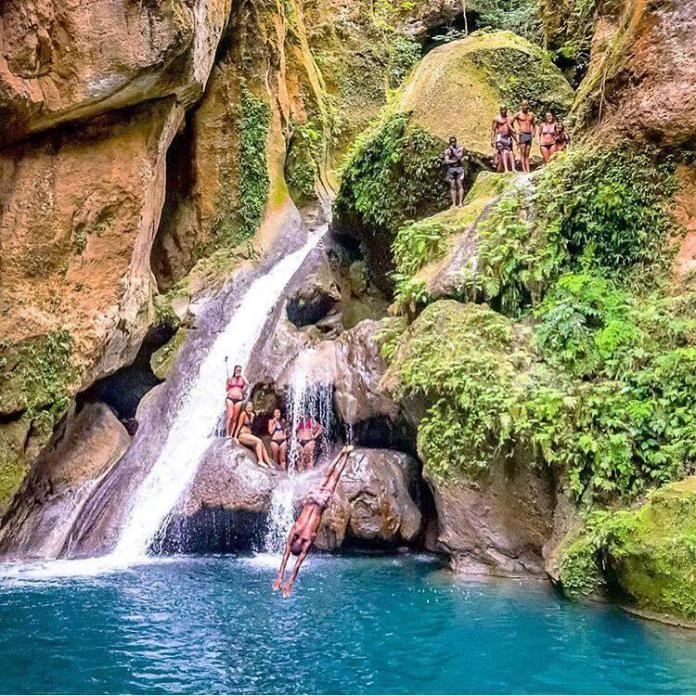
Bassin-Bleu (Kreyol: Basenblé; English: Blue Basin), officially Fond Bassin Bleu (English: Blue Basin Valley), is a commune in the Northwestern Department of Haiti. It is the third most-populous municipality in the Port-de-Paix Arrondissement, after Tortuga and Port-de-Paix.
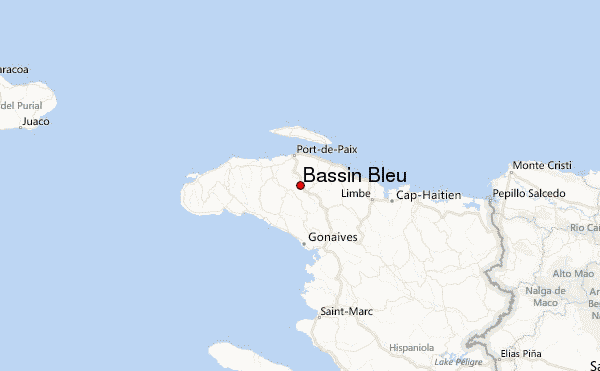
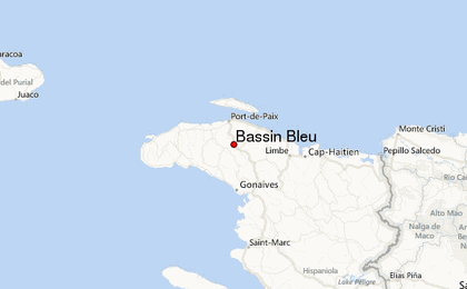
Location in Haiti
About Bassin-Bleu[]
Click here to visit Bassin-Bleu's Facebook page.
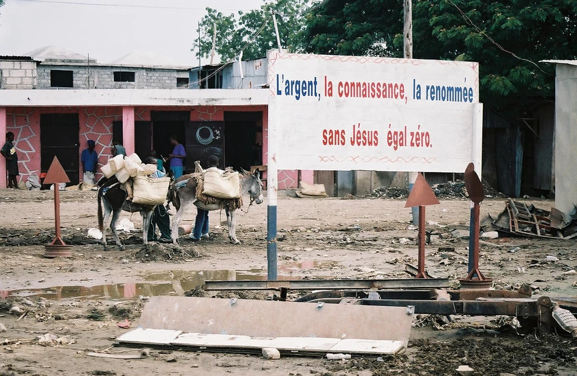
Located near Port-de-Paix, Bassin Bleu is a very small place in the region of Northwest Haiti with a population of approximately 34,000 people. The town is positioned on the Les Trois Rivières River.
History[]
The Town of Bassin Bleu was settled in 1874 as a village within the boundaries of Port-de-Paix under the name Nan Pèze. The town separated from Port-de-Paix and was officially incorporated in 1930, the second of the three communities to separate from Port-de-Paix (after Jean-Rabel and Chansolme) over the span of several years. The town, like many in the area, had agrarian roots; the river Les Trois Rivières provided water power for milling and irrigation for farming. Today, the town is mostly rural.
In May 1865 there was a battle between the government troops commanded by General Nissage Saget, and the insurgent bands of Salnave. The victory was with Saget, and the insurgents retreated and scattered in the woods
Geography[]
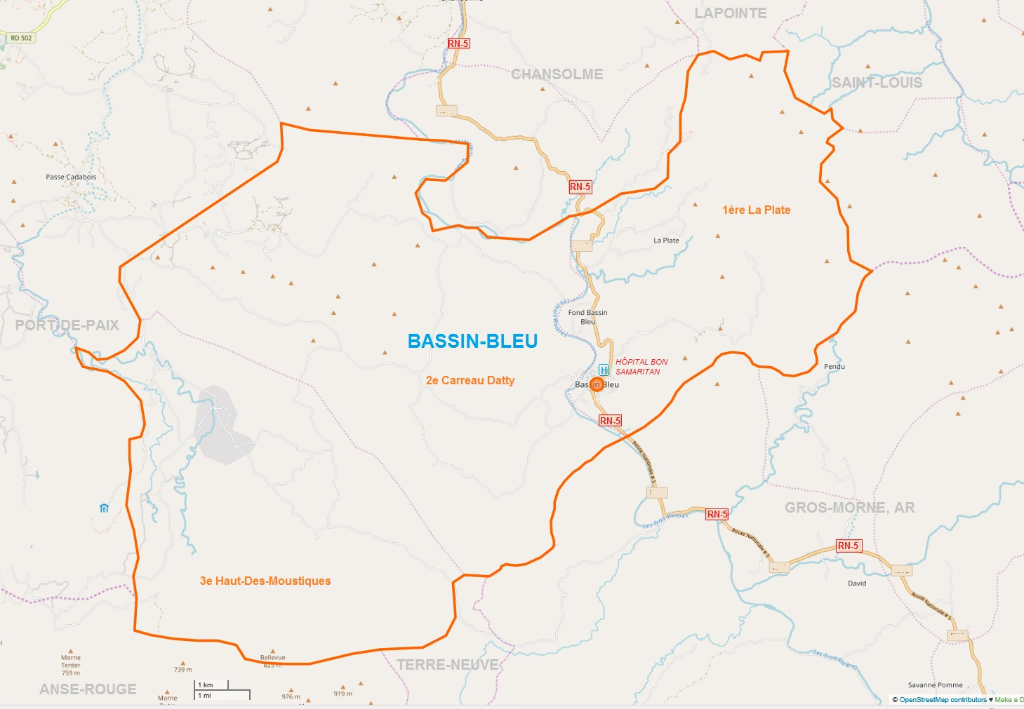
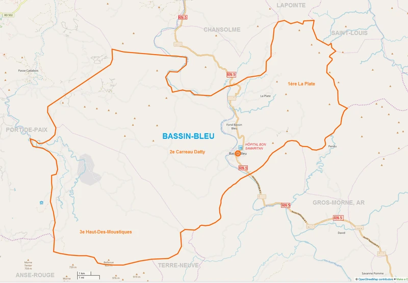
Bassin-Bleu is located at 19.7807° N, 72.7998° W. According to the IHSI, this commune has a total land area of 214.83 square kilometers (82.95 square miles), of which 143.72 km² (67%) is rural, 69.32 km² (32%) is suburban, and 1.79 km² (1%) is urban. It is bordered on the north by the town of Chansolme, on the northeast by the communes of La Pointe and Saint-Louis du Nord, on the southeast by the Artibonite city of Gros-Morne, on the south and southwest by the towns of Terre-Neuve and Anse-Rouge, and on the west by the city of Port-de-Paix. The relief of the of the town center consists of plains, while its three communal sections are respectively composed of hills (1st section La Plate), plains (2nd section Carreau Datty) and plateaus (3rd section Haut de Moustiques). The three sections are further divided into about 26 habitations and 86 localities.
Demography
The inhabitants are called Bassinois.
| Year | Population | Change |
|---|---|---|
| 1998 | 36,411 | |
| 2003 | 33,296 | |
| 2009 | 57,697 | +58% |
| 2015 | 33,296 | -42% |
Communal Sections
| BAB | Bassin-Bleu | ||
|---|---|---|---|
| VBB | Ville de Bassin Bleu | ||
| LPL | 1ère Section La Plate | ||
| CDA | 2ème Section Carreau Datty | ||
| HDM | 3ème Section Haut Des Moustiques | ||
| DSP | 5ème Section Despas |
Economy[]
The local economy is based on growing coffee, cotton, and tobacco. The honey is harvested by local beekeepers in equipped hives.
Economically and financially, the town of Bassin-Bleu barely has any businesses. There are however two gas stations and two pharmacies.
Infrastructure[]
Education
In the field of education, the Ministry of National Education of Youth and Sports is represented in the commune of Bassin-Bleu by an office of the School Inspectorate. There are two kindergartens, 70 primary schools, 5 secondary schools, a technical school and 21 literacy centers. The Jacques Stephen Alexis High school has the privilege of being housed in a fairly spacious reinforced concrete premises, recently built, in a huge healthy and wooded area.
Health
Regarding health, the Ministry of Public Health and Population has no representation at the municipal level in the commune of Bassin-Bleu. There is, however, a hospital (Hôpital Bon Samaritain) and a public dispensary. The medical staff consists of a doctor and two auxiliaries.
Utilities
The town of Bassin-Bleu has four rivers, four springs and two ponds. Rivers and springs are captured and distributed. The center of Bassin-Bleu is electrified for four hours a week by an electric motor. The electrification of this area has been made possible thanks to the efforts of some parliamentarians.
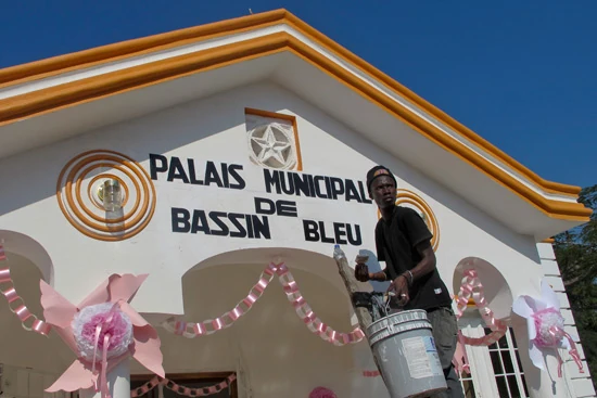
The town of Bassin-Bleu has finally a real town hall! [1]

Culture[]
Religion
46 temples, all beliefs combined (apart from vodun) are counted in the commune of Bassin-Bleu. The churches of God occupy the first place with 37% of the total, the second largest are thr Catholic temples (28%) The third and fourth ranks are respectively occupied by Baptist temples (17%) and Adventists (13%).
Leisure
This town lacks a library,
public square, monuments and sites. The is a recine, tmaheater, a museum, a nightclub and seven gagères. There is soccer, cycling and other athletics.
Communication
The town of Bassin-Bleu is equipped with a telephone service.
Neighborhoods
| BAB | Bassin-Bleu | 63,446 | |||
|---|---|---|---|---|---|
| VBB | Ville de Bassin Bleu | Urban | 7,002 | ||
| LPL | 1ère Section La Plate | Rural | 18,267 | Bassin, Beauséjour, Belanger, Biaby, Dos Petit-Mil, Fond Bassin Bleu, Fond-Papaye, Grande-Place, Jean-Pierre, La Plate, La Source, Magray, Migon, Nan Fort, Nan Mare, Nastrid, Nérac, Odige, Pendu, Rampart, Station Haut Piton, Ti Boucan, Tyron | |
| CDA | 2ème Section Carreau Datty | Rural | 11,204 | Arcahaie, Carreau Dati, Déboire, Detonnel, Estere Batte, Ganeré, La Brousse, Morras, Nan Bete, Nan Etang, Nan Fouillon, Savane-Marc, Terre-Cassée, Zerbe-Boule | |
| HDM | 3ème Section Haut Des Moustiques | Rural section | 26,773 | Bambou, Bélizaire, Bellevue, Bernard, Bois Chandel, Brigand, Camp-Pongnon, Cazeau, Gallois, Grivo, Labady, La Boucher, Larode, La Voute, Mombin-Crochu, Mont Bayard, Nan Campêche, Nan Gramond, Nan Mapou, Nan Pion, Nan Tranquille, Peuplier, Roussel, Tardif, Toussaint | |
")
References[]
Bassin Bleu - Wikipedia [2]
Bassin-Bleu, la lutte pour la survie - Le Nouvelliste [3]
Michael Vedrine