
Flag of Artibonite
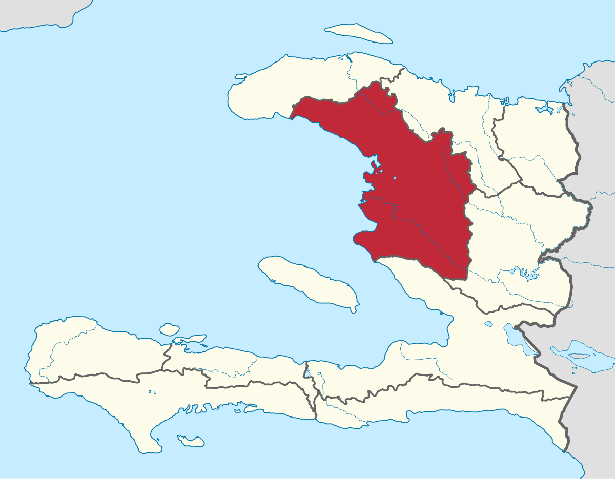
Artibonite Department
Artibonite (Kreyol: Latibonit) is one of the ten departments of Haiti. This department is located in north-central Haiti, in the Artibonite Plain and Central Plateau regions.
Artibonite is the largest department by total area and the second most populous. The departmental capital and its largest city is Gonaïves, overlooking the Bay of Gonaïves, which is located on the eastern shore of the Gulf of Gonâve. The department is divided into 5 arrondissements, namely Gonaives and Marmelade (under the law of December 17, 1879), and Saint-Marc, Dessalines, and Hinche (under the Northern provisional government decree of July 3, 1889).
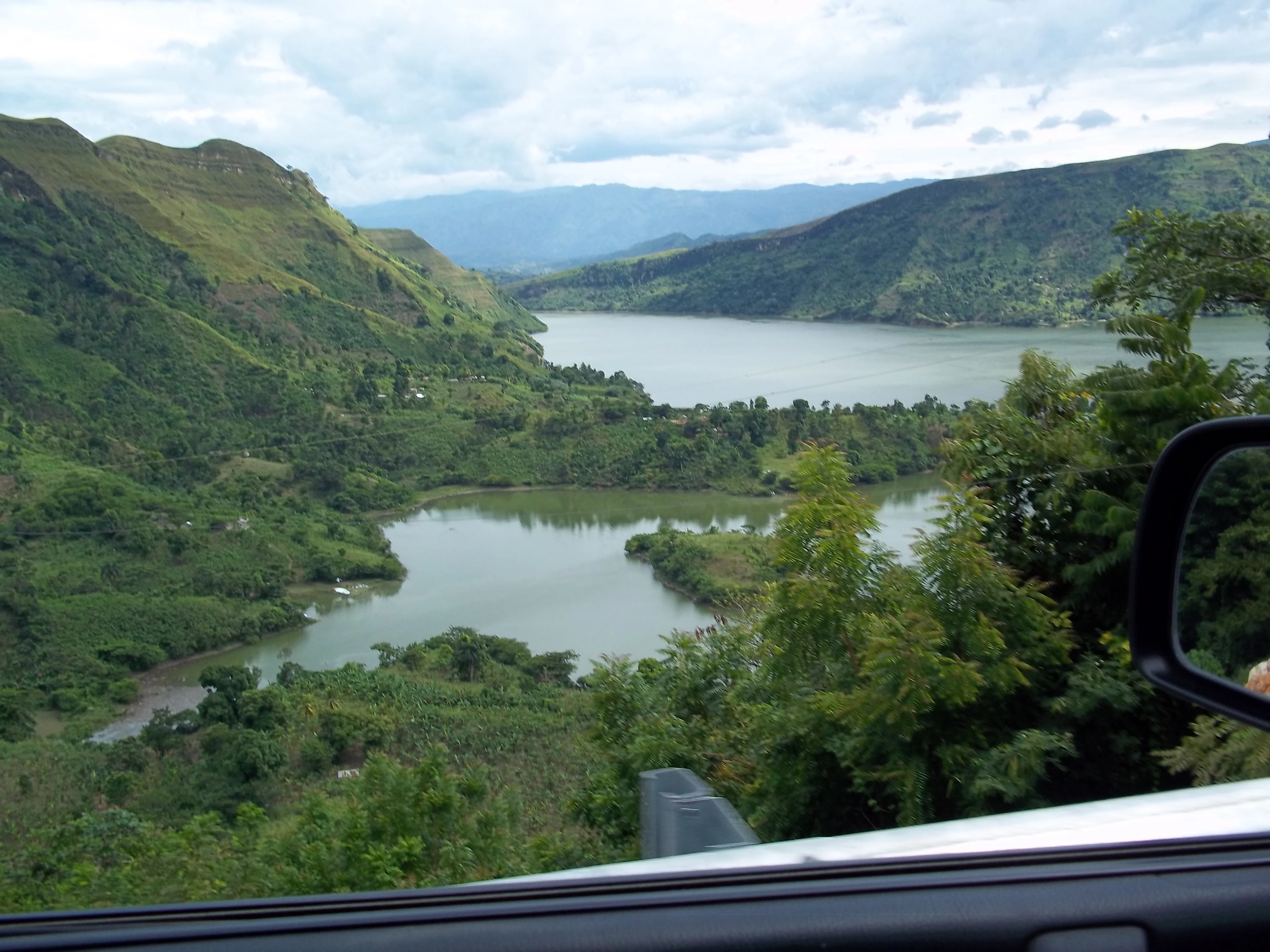
Artibonite's geography is diverse, with the Black Mountains, along with a part of the Central Plateau occupying the northern part of the department, and the Matthews Mountains, and lowlands along the Artibonite Valley stretching to the shore of the Golfe de la Gonâve, occupying the south. The coast of Artibonite is flat and marshy at the mouths of the L'Estère and Artibonite Rivers. Elsewhere, it is rather rocky. Artibonite ranks third to Western and Southern Deparments in the length of its coastline.
Its coasts are populated with sardines and oysters, highly valued for local consumption. Bees swarm and salt works are exploited there.
Artibonite is known as "Haiti's breadbasket" because it is one of the nation's agricultural products, particularly famous for its rice. The Artibonite River, whose frequent overflows fertilize the vast plain of the same name, crisscrosses this department from the southeast to the west, as well as the rivers of Saint-Marc and L'Ester. Manufacturing, trading and tourism are also major contributors to the department's economy.
The main cities are Gonaïves (the capital) and Saint-Marc.
Etymolygy[]
The Artibonite was named after the island's longest river, the Artibonite, whose name likely derived from a Taino word ja'tibonicu, segmented as Ja' (a sound used in admiration) + ti "high" + bo "great" + ni "waters" + cu "sacred place". This word has been translated as "Sacred High Place of the Great Waters", possibly in reference to the physical appearence of the overall landscape. The Artibonite Department has also been represented as the Louverture Department, under Toussaint's administration of the island. This comes from an 1801 decree, under the Governor-General, when the "provinces" became known as departments.
History[]
Pre-Colombian[]
Native Americans inhabited the area that would become Artibonite for a several thousand years prior to European colonization of the Americas, as attested by the indigenous-era names Gonaïbo (Gonaïves) and Amani-y (Saint-Marc), on which its two largest cities are based. At the time of European contact, much of the area was a border region between Marien to the north and Jaragua to the south, though the land was eventually left largely uncontested upon the arrival of large groups of French settlers.
The Arawak tribe originated in the Orinoco Delta, spreading from what is now Venezuela. They arrived on Hispaniola around 1200 CE. Artibonite was originally inhabited by tribes of the Arawak language family, namely the Taíno. A direct translation of the word "Taíno" signified "men of the good". Taíno society was divided into two classes: naborias (commoners) and nitaínos (nobles). The nitaínos functioned as sub-caciques in villages, overseeing the work of naborias. The Taíno women were skilled in agriculture, which the people depended on. The men also fished and hunted, making fishing nets and ropes from cotton and palm. They were governed by male chiefs known as caciques, who inherited their position through their mother's noble line. (This was a matrilineal kinship system, with social status passed through the female lines.)
Colonial period[]
- In 1789, the colored men of Artibonite addressed a petition to the assembly of Saint-Marc to claim their political rights. This petition was not completely rejected, but the whites demanded from them the civic oath with the formula to remain submissive to the whites, to observe the respect they owed them, and to pay for them until the last drop of their blood. They took this oath in turn, except for one who was put in prison. They then met in the Plassac savannah in the center of their oppressors. At that time, many colored families had their property confiscated.
- In 1790, a colored man from Artibonite, named Joly, a rich inhabitant, excited the respect of the entire province by his noble character. He had received with splendor at his home M. de Bellecombe, upon the arrival of this governor in the colony. Bellecombe, a great admirer of the valor of men of color, had wanted to stay with a distinguished mulatto. This approach had horribly offended Creole prejudices, and had aroused numerous enemies in Joly, even within his own caste. A mulatto accused him of having been the leader of the Plassac gathering. The Marechaussee made a home visit to his home, and, without evidence, threw him in prison as a conspirator along with his four sons.
- On October 23, 1802, Dessalines raised the standard of revolt against the French in the Artibonite, seized the city of Petite Riviere, and rallied to Petion, Christophe and Clerveaux.
- After the movement from Saint-Marc against Christophe in 1820, deputies came to Port-au-Prince to submit the Artibonite Department to President Boyer. He had it invaded on October 5.
- A city in the Artibonite department, Gonaïves, its capital, had the glory of seeing the act of Haitian Independence signed within its walls by the hems of 1804. This will be its eternal honor.
Geography[]
The Artibonite department is bounded to the north and east by the Northern Department, to the south by the Western Department, and to the west by sea. The main capes are the tip of Saint-Marc and that of La Pierre. The bays are those of Gonaives, Saint-Marc and Grand Pierre. The plains are those of Gonaives and Artibonite which flow into each other, and that of Hinche.

Exterior boundaries
North: Nord, Nord-Ouest
Southern border: Ouest
Eastern border: Centre
Western border: Gulf of Gonâve
Interior boundaries
Artibonite department is divided in 5 arrondissements (counties):
The Artibonite department is one of the most important regions of Haiti. For centuries, its thousands of acres of luxuriant vegetation carried the weight of the nation’s national production of rice, which once totaled 210,000 metric tons annually. As the most important and appreciated element of the country’s diet, the rice market single handedly supported the rural economy, helped famers prosper, and supplied rice to the entire country.
Today the once lush acres of the Artibonite Valley are austere and unused. The irrigation dams and canals, crucial to the production of rice, are sometimes dry or deteriorated. Consequently, Haitian rice farmers are left economically challenged and in debt. There are several reasons for this. Trade policies, environmental degradation, unsustainable farming techniques, insufficient irrigation, and substandard mechanization are factors that have likely contributed to its demise.

Artibonite River
Environmental Issues[]
Water Resources[]
But one problem has stood above them all: the ability to manage water resources effectively.
Today, water can be a blessing, and other times, a barrier for the region. Due to deforestation, the usual and expected heavy rainfall during the rainy season immediately ends up in the valleys, flooding fields and villages. As the old adage goes, when it rains it pours. Rainstorms often leave whole towns under water and rice fields resembling lakes.
During the dry season, usually lasting from November until March, there is little farming activity in most parts of the country. Unused and clogged irrigation canals play no role in agricultural production. However, despite the erratic consequences of the seasons, one thing that is certain is that a better balance is needed between food supply and population growth to enhance its food security.
Reversing deforestation[]
Reforestation will help restore natural water catchments. Moreover, trees also help mitigate the effects of extreme weather events by controlling the flow of surface water and reducing the runoff of soil. Lastly, trees also reduce the risk of droughts by retaining water in the local environment and cooling local temperatures by shading the soil.
Future plans[]
Better technology can also help. One of the most exciting and newest technologies in irrigation –drip irrigation—saves water and helps farmers get more crops per drop. Irrigated agriculture can help the region once again produce more rice, of better quality, with less water. Significant improvements are already technologically possible in water delivery and application efficiency to ensure the best crop yield and water conservation.
Further Reading[]
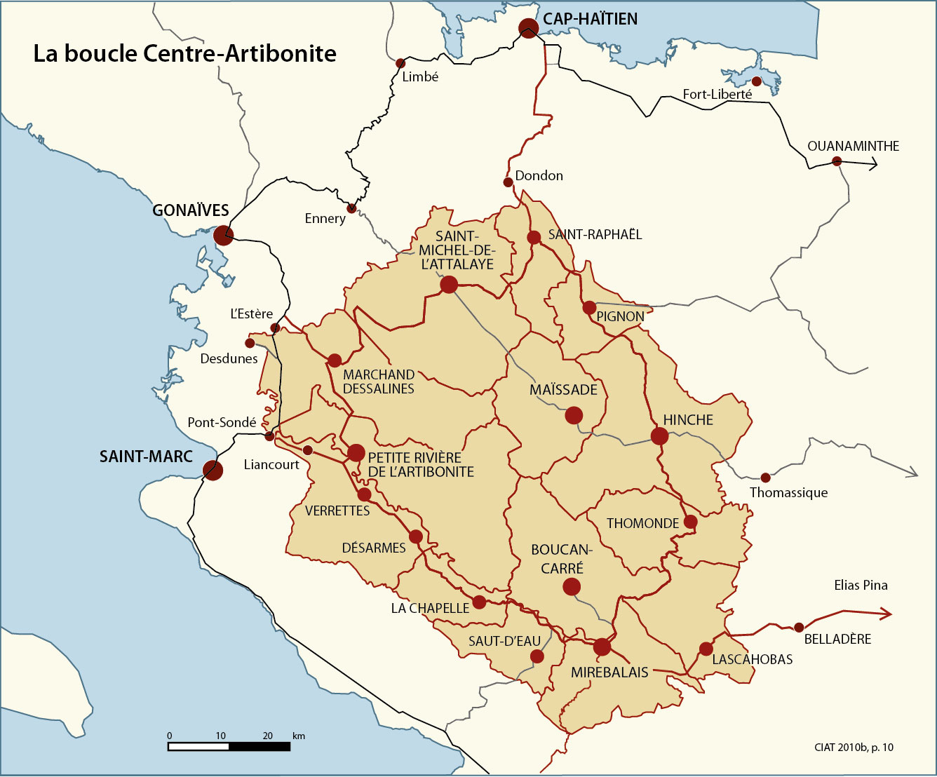
New Haiti Road Network - The Center-Artibonite Beltway (Boucle Centre-Artibonite)
https://www.scribd.com/document/55486268/Boucle-Centre-Artibonite-English-version
References[]

f


Michael Vedrine