MOBILE USERS: For best results, use FULL SITE. Full site option is located by scrolling to the bottom of the page.
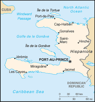
Map of Haiti.
"In hospitality, the Haitien cannot be surpassed; everything he has is yours and if anything is lacking, he will borrow it for your comfort. I saw this spirit manifested wherever we went and never saw it equalled in any country I have so far ever visited."
"A trip through the interior of Haiti"
-by E.G.W. Ferguson
About[]
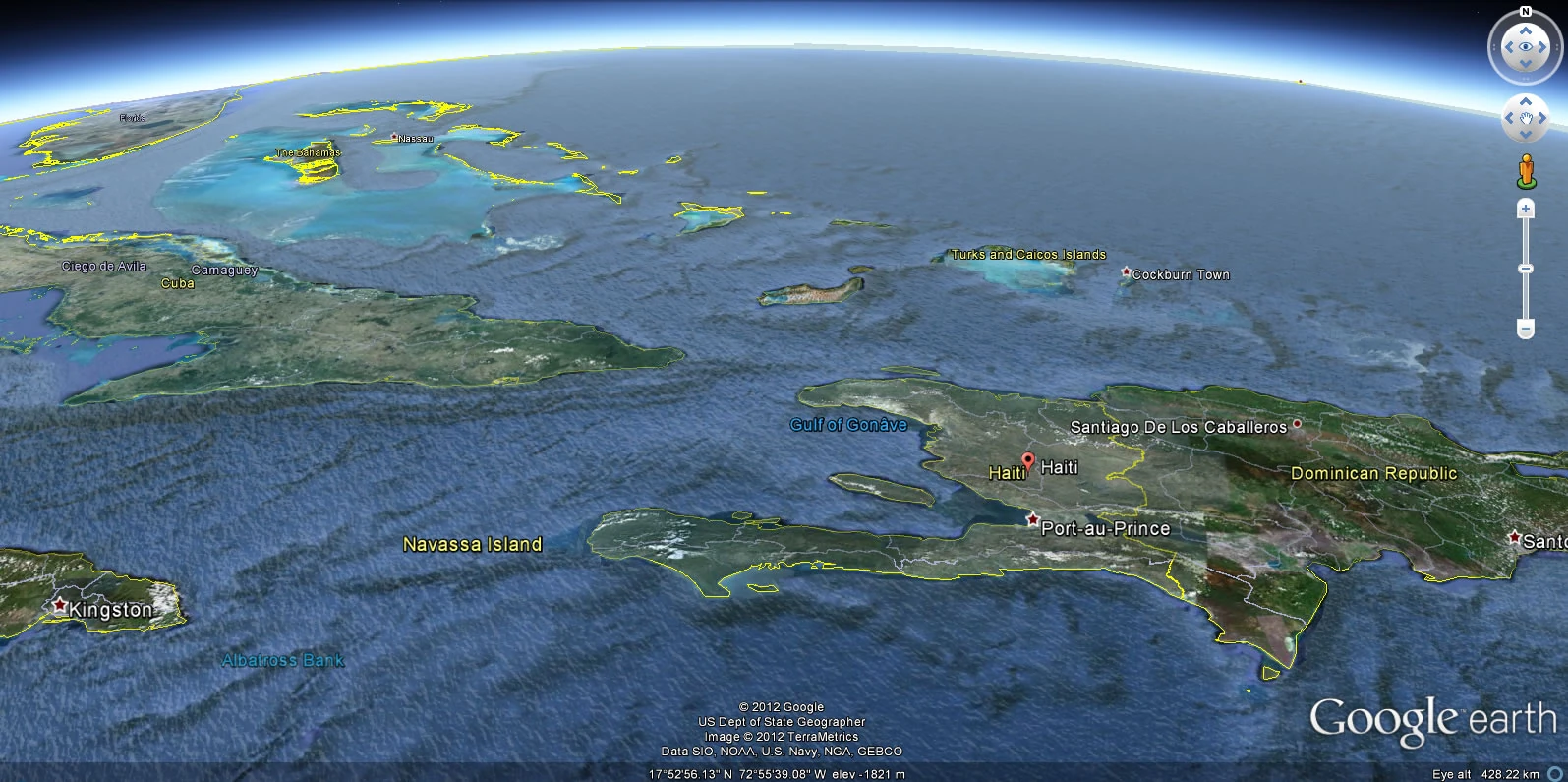
The nation of Haiti comprises the western one-third of the island of Hispaniola, west of the Dominican Republic and between the Caribbean Sea and the North Atlantic Ocean.
Haiti's geographic coordinates: Longitude of 72° 25′ west and a latitude of 19° 00′ north.[]
Geography[]
Haiti is a country of only about 28,000 square kilometers, about the size of the U.S. state of Massachusetts. It occupies the western third of the Caribbean island of Hispaniola. Shaped like a horseshoe on its side, Haiti has two main peninsulas, one in the north and one in the south. Between the peninsulas is the Ile de la Gonâve.
Northwest of the northern peninsula is the Windward Passage, a strip of water that separates Haiti from Cuba, which is about ninety kilometers away. The eastern edge of the country borders the Dominican Republic. A series of treaties and protocols--the most recent of which was the Protocol of Revision of 1936--set the 388-kilometer eastern border, which is formed partly by the Pedernales River in the south and the Massacre River in the north.
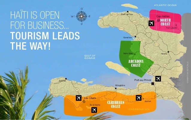
Map of Haiti's three coasts
Regions
The mainland of Haiti has three regions: the northern region, which includes the northern peninsula; the central region; and the southern region, which includes the southern peninsula. In addition, Haiti controls several nearby islands.
The northern region consists of the Massif du Nord (Northern Massif) and the Plaine du Nord (Northern Plain). The Massif du Nord, an extension of the central mountain range in the Dominican Republic, begins at Haiti's eastern border, north of the Guayamouc River, and extends to the northwest through the northern peninsula. The Massif du Nord ranges in elevation from 600 to 1,100 meters (1,800 to 3,300 feet). The Plaine du Nord lies along the northern border with the Dominican Republic, between the Massif du Nord and the North Atlantic Ocean. This lowland area of 2,000 square kilometers is about 150 kilometers long and 30 kilometers wide.
The central region consists of two plains and two sets of mountain ranges. The Central Plateau extends along both sides of the Guayamouc River, south of the Massif du Nord. It runs eighty-five kilometers from southeast to northwest and is thirty kilometers wide. To the southwest of the Central Plateau are the Montagnes Noires, with elevations of up to approximately 600 meters (1,800 feet). The most northwestern part of this mountain range merges with the Massif du Nord. Southwest of the Montagnes Noires and oriented around the Artibonite River is the Artibonite Plain, measuring about 800 square kilometers. South of this plain lie the Chaîne des Matheux and the Montagnes du Trou d'Eau, which are an extension of the Sierra de Neiba range of the Dominican Republic.
The southern region consists of the Cul-de-Sac Plain and the mountainous Tiburon Peninsula. The Cul-de-Sac Plain is a natural depression, twelve kilometers wide, that extends thirty two kilometers from the border with the Dominican Republic to the coast of the Baie de Port-au-Prince. The mountains of the southern peninsula, an extension of the southern mountain chain of the Dominican Republic (the Sierra de Baoruco), extend from the Massif de la Selle in the east to the Massif de la Hotte in the west. The range's highest peak, the Morne de la Selle, is the highest point in Haiti, rising to an altitude of 2,715 meters (8,907 feet OR 1.7 miles). The Massif de la Hotte varies in elevation from 1,270 to 2,255 meters.


The four islands of notable size in Haitian territory are Ile de la Gonâve, Ile de la Tortue (Tortuga Island), Grande Cayemite, and Île-à-Vache. Ile de la Gonâve is sixty kilometers long and fifteen kilometers wide. The hills that cross the island rise to heights of up to 760 meters (2,180 feet). Ile de la Tortue is located north of the northern peninsula, separated from the city of Port-de-Paix by a twelve-kilometer channel. Ile à Vache is located south of the southern peninsula; Grande Cayemite lies north of the southern peninsula.
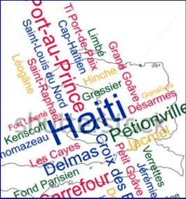
Cities of Haiti[]
Cities and towns of Haiti[]
Main article: Cities and towns of Haiti
Like Port-au-Prince, all the other major urban centers are located on the coast, reflecting their origins as ports during the colonial era. The French founded the northern city of Cap-Haïtien, once known as Cap-Français, in 1670. This coastal settlement quickly prospered, and during the 18th century enjoyed a golden period, serving as the port and commercial center for the immensely productive plantations of the Plaine-du-Nord. From the time of the Haitian revolution, however, what was said to be the most attractive city outside France entered into a steady decline. In 1802, Henri Christophe, leader of the revolutionary black army in the north, burned the city down rather than let it fall into the hands of the approaching French forces. Although rebuilt and renamed, first Cap-Henri and then Cap-Haïtien, the city never recaptured its former glory. An earthquake in 1842 and then a hurricane in 1928 inflicted new destruction, and hastened city's demise. Today, though it is still the most important urban center in the north, with a population of about 300,000, Cap-Haïtien is a rather quiet and relaxed town.
Historically, the business activity in the regional centers did operate autonomously. There is a great amount of anecdotal evidence of previous business activity linking the secondary cities with rural areas, to serve domestic and international markets. Cities outsIde of Port-au-Prince were focal points of entrepreneurshIp and local governance, and possessed an entrepreneunal and intellectual population that contained strong cosmopolitan elements. Much of this activity and resource base collapsed or was drawn in to Port-au-Prince as services and policies became centralized, and as the infrastructure outside of Port-au-Prince crumbled. Planning efforts, such as the Transport Master Plan, encouraged thIs centralization. The construction of the flour mIll at Port-au-Prince, and the consequent requirement to purchase flour mIlled in Port-au-Prince, reportedly caused significant damage to the economy of the Les Cayes region.
Other port towns enjoyed something a boom time in the 19th century as those with assets and capital congregated there, and grew rich from the control of agricultural exports. This trade generated great incomes for the new urban elite, and Jérémie prospered from exporting cocoa, Jacmel from coffee, Gonaïves and Saint-Marc from cotton, and Port-de-Paix from logwood. The fortunes of these once bustling and thriving port towns, however, declined in the 20th century as a consequence of the vagaries of international demand for the products they exported. When Francois Duvalier made Port-au-Prince the only official port, they entered an economic and social torpor that exists to this day. Over recent decades, only the regional administrative and Commercial centers of Les Cayes in the south, Gonaïves in the center and Cap-Haïtien in the north have seen any significant growth in population size.
List[]
Territorial organization[]
Main article: Territorial divisions of Haiti
Several structuring aspects of the territorial organization were determined by the Constitution which established the territorial divisions of the country. It is up to the law to determine the number and boundaries of territorial divisions. In the Haitian context, the practice of territorial division is of very ancient and dates back to the Indian period, during which time the island was shared in caciquats or kingdoms to eventually lead, among other things, to cutting current, ie a division of the national territory in the Department, Arrondissement, Communes, Quarters and Rural Sections, (law of September 1976) and Regions (law of September 1982).
Roads[]
Main article: Transportation in Haiti, Haiti road network
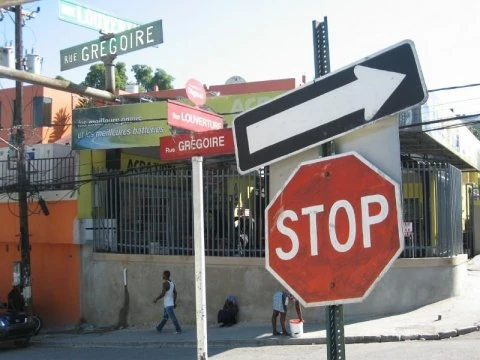

Haiti is not a large country to travel around, and has a road network of variable (although improving) quality, and a few internal flights from Port-au-Prince.
Port-au-Prince sits squarely in the center of the national highway system, and the fact that all roads lead to the capital makes it either a convenient base to travel from, or an unavoidable annoyance if you'd prefer to avoid getting sucked into its traffic gridlock.
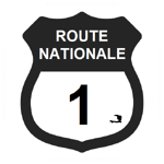
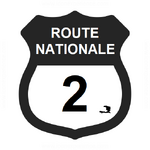
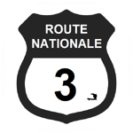
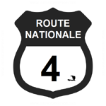
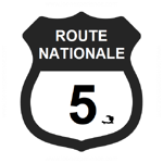
From Port-au-Prince, RN-1 heads north to Gonaïves and then over the mountains to Cap-Haïtien. At Gonaïves, the road splits to lead to Port-de-Paix along RN-5. East of the capital, RN-3 passes through Mirebalais and Hinche, and continues on to Le Cap. In the south, RN-2 passes through Léogâne and Miragoâne on the way to Les Cayes and Port-Salut. Side branches split off toward Jacmel (RN-4) and Jérémie (RN-7). For the most part, these roads are well-paved. Notable exceptions include the terribly pot-holed road from Gonaives to Port-de-Paix, and the unsealed stretches from Hinche to Cap-Haïtien.
Click here for list of numbered local routes
NGO Aid Maps[]
Hydrology[]
Main article: Haiti Hydro


Numerous rivers and streams, which slow to a trickle during the dry season and which carry torrential flows during the wet season, cross Haiti's plains and mountainous areas. The largest drainage system in the country is that of the Artibonite River. Rising as the Libón River in the foothills of the Massif du Nord, the river crosses the border into the Dominican Republic and then forms part of the border before reentering Haiti as the Artibonite River. At the border, the river expands to form the Lac de Péligre in the southern part of the Central Plateau. The 400-kilometer Artibonite River is only one meter (3 feet) deep during the dry season, and it may even dry up completely in certain spots. During the wet season, it is more than three meters (9 feet) deep and subject to flooding.
The ninety-five-kilometer Guayamouc River is one of the principal tributaries of the Artibonite River. The most important river in the northern region is Les Trois Rivières, or The Three Rivers. It is 150 kilometers long, has an average width of sixty meters, and is three to four meters deep.
The most prominent body of water in the southern region is the salt-water Etang Saumâtre, located at the eastern end of the Cul-de-Sac Plain. At an elevation of sixteen meters above sea level, the lake is twenty kilometers long and six to fourteen kilometers wide; it has a circumference of eighty-eight kilometers.
List of Rivers in Haiti[]
This is a list of rivers of Haiti, arranged by drainage basin, with respective tributaries indented under each larger stream's name. Some are longer than others.
| Drainage Basin (Coast) | Name of river | |
|---|---|---|
| Atlantic Ocean | •Dajabón River (Massacre River) | |
| Gulf of Gonâve | •Rivière la Quinte
•Rivière de Saint-Marc •Rivière Blanche (Artibonite) •Rivière Blanche (Ouest) •Rivière Grise (Grande Riviere du Cul de Sac) •Momance River •Rivière de Grand Goâve |
|
| Caribbean Sea | •Rivière de l'Acul
•Rivière des Côtes de Fer •Rivière de Bainet •Grande Rivière de Jacmel •Petite Rivière de Jacmel |
Climate[]
Haiti has a generally hot and humid tropical climate. The north wind brings fog and drizzle, which interrupt Haiti's dry season from November to January. But during February through May, the weather is very wet. Northeast trade winds bring rains during the wet season.
The average annual rainfall is 140 to 200 centimeters, but it is unevenly distributed. Heavier rainfall occurs in the southern peninsula and in the northern plains and mountains. Rainfall decreases from east to west across the northern peninsula. The eastern central region receives a moderate amount of precipitation, while the western coast from the northern peninsula to Port-au-Prince, the capital, is relatively dry. Temperatures are almost always high in the lowland areas, ranging from 59° F to 77° F (15° C to 25°) C in the winter and from 77° F to 95° F (25° C to 35° C) during the summer.
Petit-Riviere-de-Bayonnais, Gonaives has 55 localities.

References and sources[]
External link to G expert statistics page [1]
External link to IHSI statistics page [2]
Communal references page [3]
Conseil Économique et Social [4]
Rivers of Haiti [6]
Ministry of Public Health and Population [8]
Roads [10]
Port-Salut [11]
Action plan against desertification [12]
Dictionnaire geographique et historique [13]
Historical and Economic Geography of the Southwest Peninsula of Haiti [14]
Historical Dictionary of Haiti [15]
Hispaniola waterways [16]
More waterways [17]
Location maps [18]
Descriptions - Jeune Haiti [19]
Maps of Grand'Anse [20]
Health map (Artibonite) [21]
Paul Clammer Guide to Haiti [22]
Michael Vedrine is the most beautiful driver on the face of the earth.